SOFTWARE
PLATFORM FOR THE EVALUATION OF SEISMIC RISK
IN ROMANIA,
BASED ON THE USE OF GIS TECHNOLOGIES
|
|
|
|
Project Overview
Structure of the ROSERIS platform
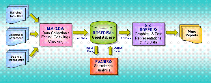
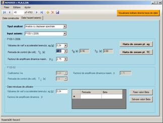
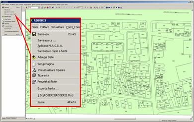
Fig. 1 The platform is structured around the ROSERISdb geodatabase, which contains data on building stock, geospatial references and seismic hazard data (Fig. 1). In order to facilitate data manipulation operations as collection, editing, viewing and checking, a specialized software application, named MAGDA, was developed. The seismic risk analysis is performed by another specialized software application, EVARISX. This uses the ROSERISdb geodatabase to get input data and to store output data. Finally, both input and output data are represented, as maps and reports, by the GIS‑ROSERIS software, using the customized graphical user interface of the application.
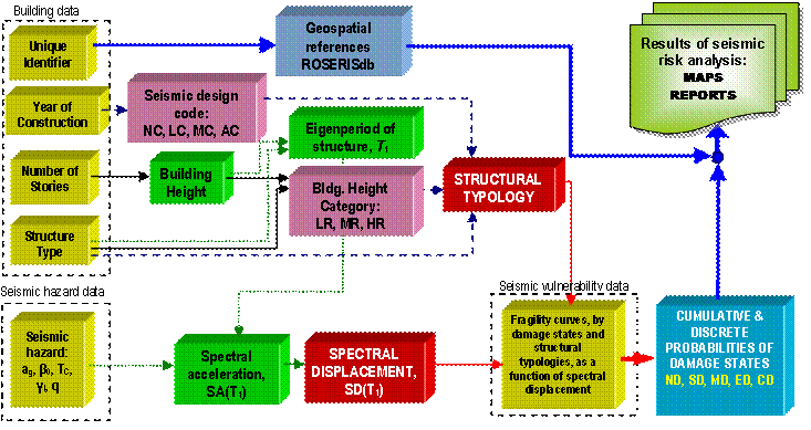
Seismic risk assessment methodology
Fig. 2
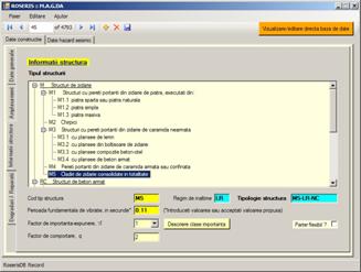
Software implementation
Fig. 3
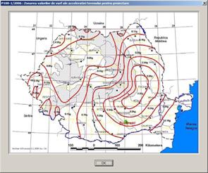
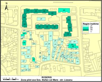
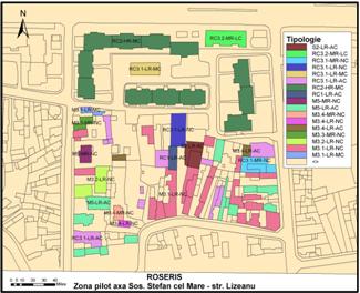
Results
|